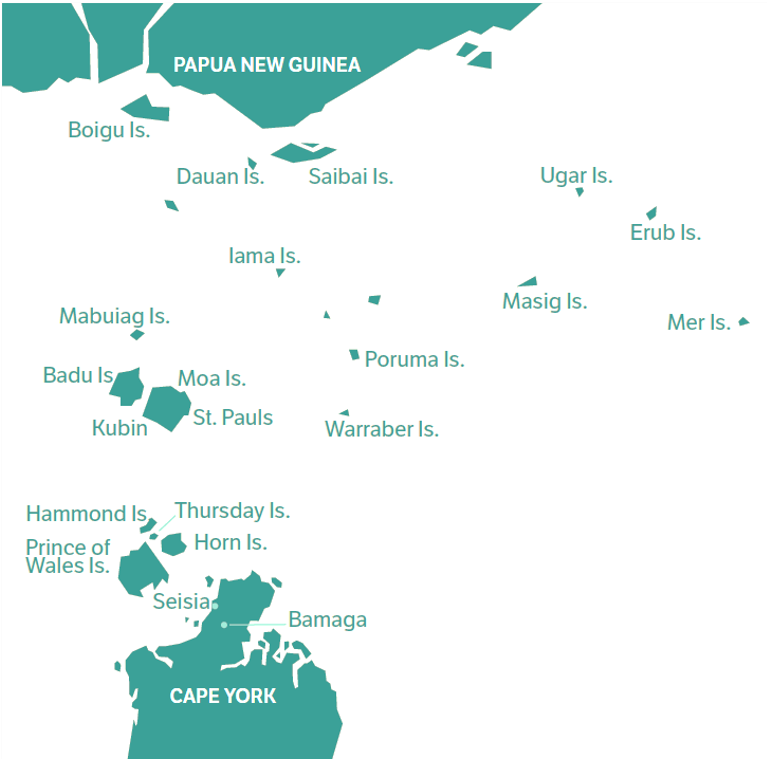
The Torres Strait
The Torres Strait stretches 150 kilometres northwards from Cape York Peninsula to Papua New Guinea and up to 300 kilometres from east to west. This 48,000 km² area includes more than 270 islands and reefs.
TSRA supports programs across the region, including for 17 inhabited islands of the Torres Strait and the communities of Bamaga and Seisia on the Northern Peninsula Area of mainland Australia.
About TSRA’s Mapping and GIS services
The TSRA has developed an interactive online map of the region.
This map can be used to explore various spatial datasets including land parcels, roads and legislative boundaries like the fisheries jurisdictions and IPA islands.
The TSRA works with communities, government agencies, consultancies, NGOs, and researchers to develop and share spatial information about the Torres Strait region. Geographic Information Systems (GIS) are used to create maps and analyse spatial information.
Further GIS, map and spatial information on the Torres Strait region is available from the TSRA upon request by contacting GIS@tsra.gov.au.
Spatial information can also be sourced from the Torres Strait E-Atlas and the Queensland Globe.